I didn’t know much about Alaska when I was young. Yes, I knew that it was the 49th state and that it was admitted to the union in 1959 (January 3, just a few months before Hawaii). For about six months we had a 49 star flag. I had also learned that the U.S. purchase of Alaska was once referred to as Seward’s Folly—what possible value could there be in that ice-encrusted wasteland? The discovery of gold in the Klondike changed all that.
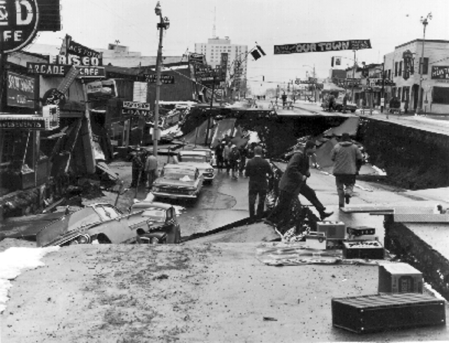
It was the post-March 27, 1964 (Good Friday) earthquake coverage by Life Magazine that changed the way, any at all, I thought about Alaska, Anchorage in particular. My parents subscribed to Life Magazine and I usually read each edition mostly cover-to-cover. The photography was among the best, always adding a second dimension to any of the stories they covered. The April 15 edition had a front page picture of a mangled house that had traveled downhill during the quake. More mesmerizing were the photos of where the ground had subsided leaving huge holes and places where sections of roadways had disappeared into oblivion. The quake, estimated at 9.2-9.3, with 11 aftershocks of 6.0 or larger, left damage and death everywhere. A 220 foot tsunami wiped out villages in Shoup Bay. The town of Valdez was destroyed—it was relocated when rebuilt in anticipation of the next big one. One upside of the quake was how seismologists were able to use this “demonstration” to add to their understanding of plate tectonics. The USGS has several very interesting videos regarding the Alaska quake and what they learned—e.g., there have been a number of similar quakes here in the last 5,000 or so years—an average of about one of this magnitude in every 600 years.
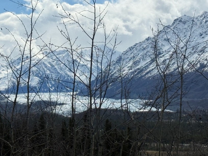
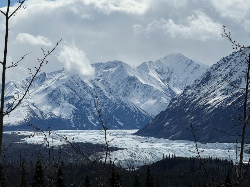
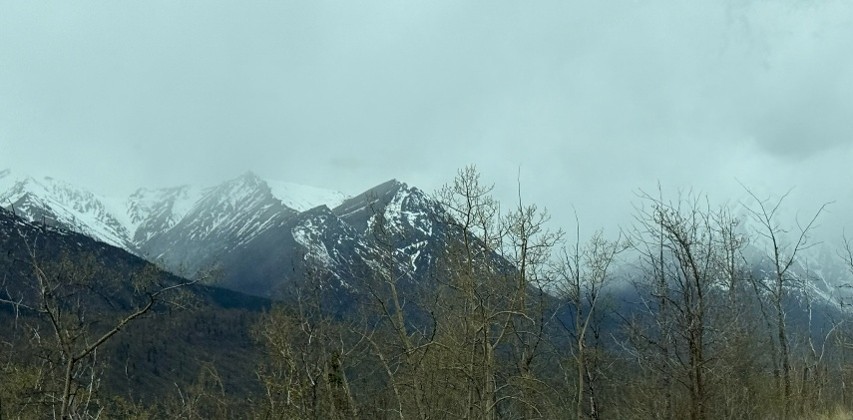
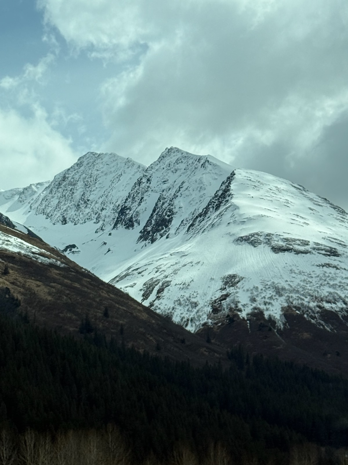
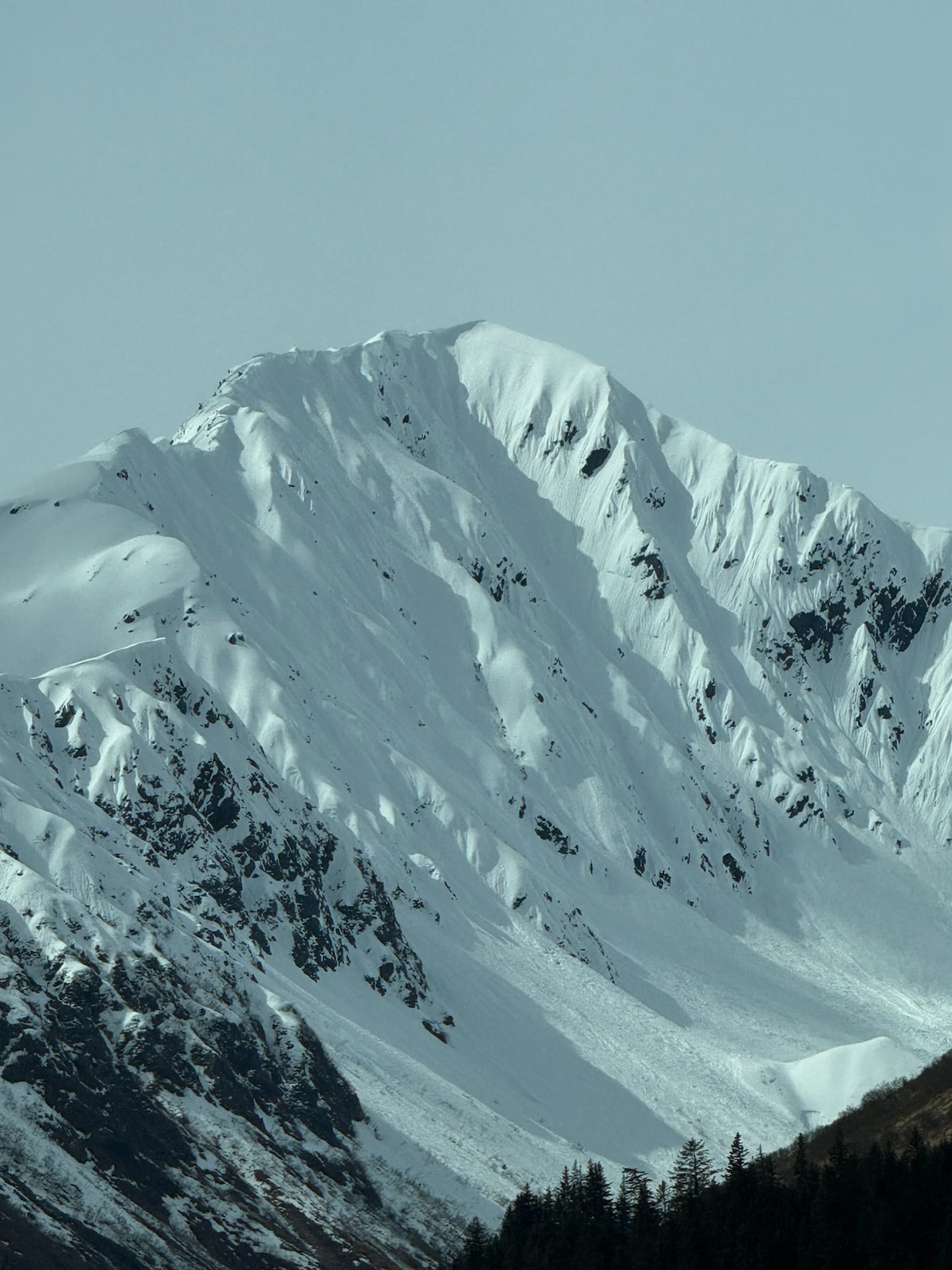
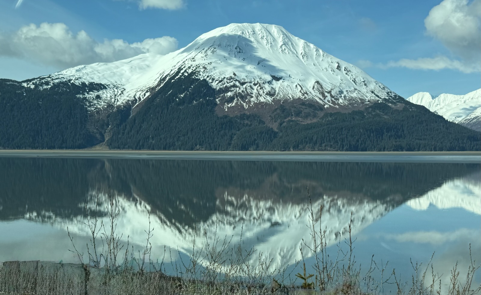
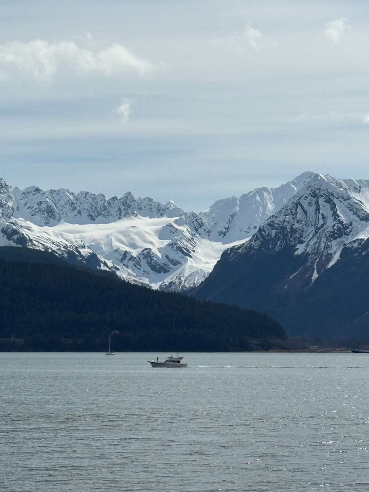
This part of Alaska, and the two-hour drive south to Seward, is wonderful. Even in late May, the mountains are covered by snow, not all, and there are numerous opportunities to view glaciers. The first picture here below is Matanuska Glacier, north of Anchorage near Palmer. The run-off from the glacier feeds the Matanuska River which flows southwest to Cook Inlet, the western coastline of Anchorage. The other two pictures are views of the mountains along the drive north and east of Anchorage.
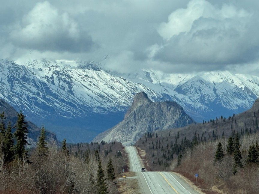
Anchorage and the road south to Seward is bounded by mountains to the east, north, and south. To the west of Anchorage is Cook Inlet, although off in the distance you can see Mt. Redoubt, an active volcano. When Janet was here 19 years ago, Mt. Redoubt was smoking. Redoubt erupted as recently as 2009. Part of the ride to Seward is along the Turnagain Arm, an offshoot of Cook Inlet. From there, one can observe Beluga Wales, a wonderful collection of birds, and more mountains. The ride beyond the arm is a mix of mountains and meadows that were carved out by glaciers 10,000 years ago.
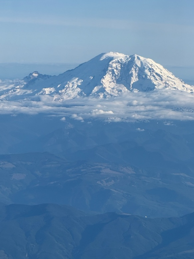
One more thing. We attempted to view Denali on a one-day trip north of Anchorage—too many clouds. Our disappointment was soothed on our flyout from the Seattle airport (to Omaha). We were on the correct side of the plane on an almost cloud-free day. Please observe Mt. Rainier from about 20,000 feet.